
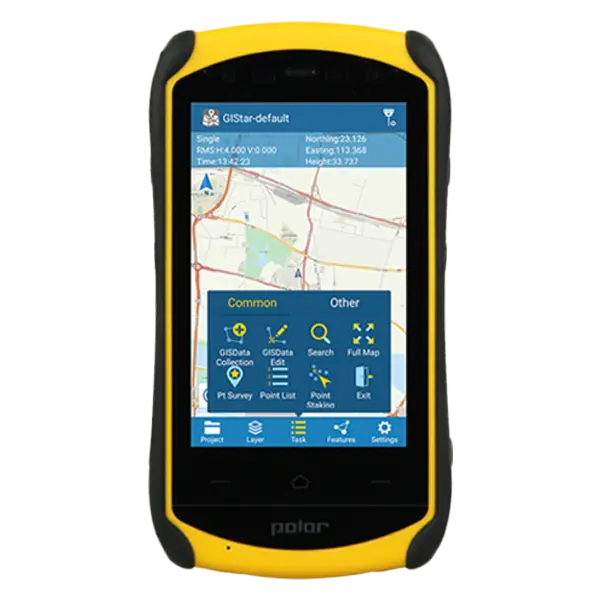
South X2
X2, Android, with 2G module/GPS/camera, touch screen
● New design appearance and very comfortableto hold
● HD large 5inch touch screen fulfilling the Android users needs
● Quad-Core 1.5GHz processor
● Multiple sensors and more extended functions
● Micro-USB port and OTG function
Additional information
| Weight | 1 kg |
|---|---|
| Dimensions | 156 × 85 × 29 mm |
Specification
| System | Operating system | Android 5.1 |
| CPU | Octa-Core 1.5GHz | |
| Memory | 3GB RAM, 32GB ROM | |
| Storage | up to 128G extensible | |
| GNSS performance | Channels | 72 |
| GPS | L1 | |
| GLONASS | L1 (optional) | |
| BDS | B1 | |
| GALILEO | – | |
| SBAS | – | |
| QZSS | – | |
| Data output | NEMA-0183 | |
| I/O protocol | RTCM2.3 (1,3,9), RTCM31 | |
| Update rate | 1Hz | |
| Reacquisition | <1s | |
| Warm start | – | |
| Cold start | <30s | |
| Accuracy | Single positioning | 5m |
| SBAS positioning | 2 ~ 5m | |
| DGNSS | 1 ~ 3m | |
| RTK(baseline<30km) | – | |
| Multimedia | Camera | 8.0 megapixel AF, flashlight |
| Display | 5.0 inch capacitive screen, 1280 × 720 | |
| Sensor | Electronic compass, gravity sensor, built-in thermometer, atmospheric pressure altimeter, light sensor and distance sensor (optional) | |
| Other function | Integrated speakers and microphone | |
| Extended function(optional) | Scanning head, NFC, backtalk, Fingerprint identification | |
| Communication | network | WCDMA 3G modem |
| Bluetooth | BT4.0 downward compatible to BT2.1 + EDR | |
| WIFI | IEEE 802.11 b/g/n | |
| USB | Micro USB, support charging and OTG function | |
| Electrical | Battery | 3.7V, 4200mAh Li-Ion, 2 batteries (standard) |
| Battery life | Single battery > 10 hrs | |
| Battery charging | 2 stands charger, 4 hrs fast charging | |
| Environment | Waterproof/Dustproof | IP67 |
| Shockproof | 1.5m | |
| Humidity | – | |
| Operating temperature | – | |
| Storage temperature | -40℃ ~ 80℃ | |
| Physical | Dimension | 156mm(L) × 85mm(W) × 29mm(H) |
| Weight | 0.32kg (battery included) |
Note: all information above is subject to change without any prior notice.
Brochure Download
You must be logged in to post a review.
Related products


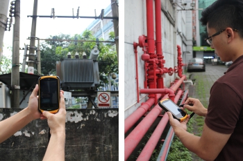
Whether you are conducting land surveying, construction layout, mapping, or managing complex geospatial data, Geomatics Gear provides reliable tools that help you maintain accuracy and efficiency on every project. Our solutions are built to perform in challenging environments, ensuring consistent results when it matters most.
In addition to top-tier equipment, our team offers knowledgeable support to help you choose the right tools for your workflow. With Geomatics Gear, you gain access to trusted technology and expertise that keeps your projects moving forward with confidence.
Reviews
There are no reviews yet.