
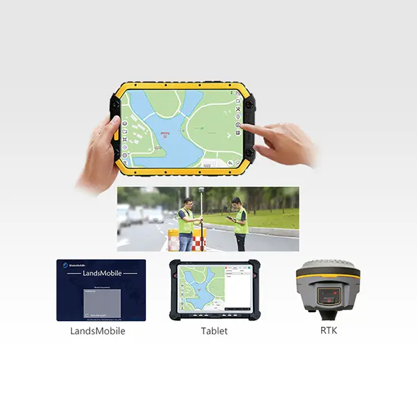
Cadaster Palm Surv-lution LandsMobile
- LandsMobile is a mobile software running on an Android OS(Operating System) tablet, with simple interface and easy operation. It is one-stop integrated for data capture, attributes investigation and mapping on field.
Features
● Based on independent and proprietary graphic platform.
● Real-time data saving and dual backup.
● Real-time positioning and network map loading.
● High-precision positioning and data capture by connecting to RTK via Bluetooth.
● Customization available for attribute contents,menu, symbolic expression effect,etc. for different project requirements.

Applications
Applications
● Topographic Survey (location & attributes)

● Pipeline Survey (attributes survey & draft)

● City Components Survey (location capture & attributes)

● Power Factors Survey (attributes survey & draft)

● Aerial Image Control Survey

● Land Survey (attributes & photo records)

Brochure Download
Download Brochure
You must be logged in to post a review.
Related products


Whether you are conducting land surveying, construction layout, mapping, or managing complex geospatial data, Geomatics Gear provides reliable tools that help you maintain accuracy and efficiency on every project. Our solutions are built to perform in challenging environments, ensuring consistent results when it matters most.
In addition to top-tier equipment, our team offers knowledgeable support to help you choose the right tools for your workflow. With Geomatics Gear, you gain access to trusted technology and expertise that keeps your projects moving forward with confidence.
Reviews
There are no reviews yet.