Mapping Software
Mapping Software
Turning field measurements into professional, accurate maps requires more than just good data — it requires the right software to process, draft, and deliver finished results that meet the standards your clients and projects demand. Geomatics Gear’s Mapping Software subcategory features purpose-built CAD mapping solutions designed for surveyors, engineers, and geospatial professionals who need a powerful, reliable desktop environment to take their data from raw measurements to polished, deliverable maps.
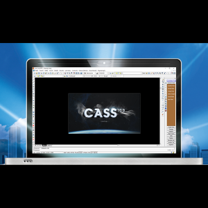
The cornerstone of this category is CAD Mapping Software CASS by South Instrument — a widely used, AutoCAD-based mapping platform trusted by survey and engineering professionals across the industry. CASS is built specifically for the geomatics workflow, offering a comprehensive set of tools that address every stage of the office mapping process, from initial data import through to final map production.
CASS excels at topographic map drawing, allowing users to rapidly generate accurate topo maps from field data with an intuitive, familiar CAD interface. Its earthwork calculation tools deliver high-precision volume computations using straightforward, verifiable methods — an essential capability for engineers and surveyors working on grading, cut-and-fill, and site development projects. For transportation and infrastructure professionals, CASS includes fast road curve design tools that support importing, drawing, and processing road curve element files with minimal manual effort. The software also handles section mapping, producing clean, presentation-ready cross-section and profile drawings that meet the expectations of engineers, planners, and regulatory reviewers.
Because CASS is built on an AutoCAD foundation, it offers a familiar drafting environment that reduces training time and integrates smoothly with existing CAD-based office workflows. Survey teams already working in a CAD environment will find CASS an intuitive addition that enhances productivity rather than disrupting established processes.
Whether you are a land surveyor producing cadastral and topographic plans, a civil engineer working on site grading and road design, or a GIS professional generating mapping deliverables, CASS provides the tools to do the job accurately and efficiently.
Geomatics Gear offers expert support and flexible financing on all mapping software. Contact our team for current pricing or to request a personalized quote.
Showing all 2 resultsSorted by price: high to low