
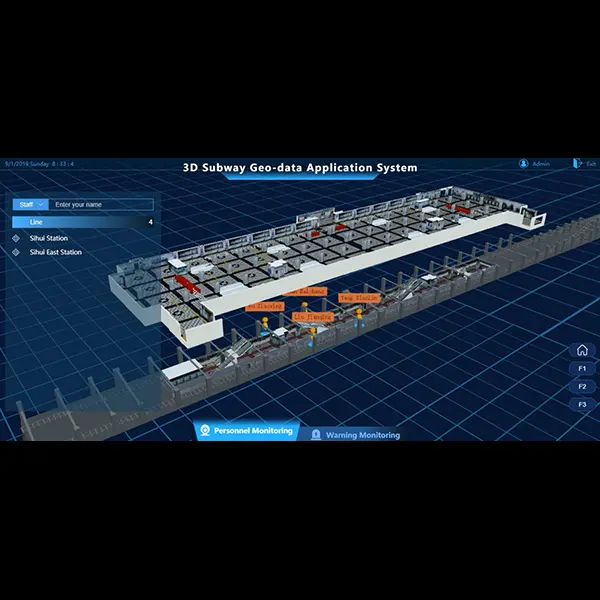
3D Subway Geo-data Application System
- Based on Real 3D Big Data Platform and location-based service technology, 3D Subway Geo-data Application System provides all-round and high-precision positioning, monitoring and visualization.
Features
● High-precision monitoring of staff numbers and locations through 3D scenes.

● Real-time monitoring and historical track playback for supervision and management of personnel

● Intelligent Geo-fence settings and emergency alarm to ensure safety

Applications
Applications
3D Subway Geo-data Application System of Beijing Metro (Sihui Station to Sihui East Station)

You must be logged in to post a review.


Whether you are conducting land surveying, construction layout, mapping, or managing complex geospatial data, Geomatics Gear provides reliable tools that help you maintain accuracy and efficiency on every project. Our solutions are built to perform in challenging environments, ensuring consistent results when it matters most.
In addition to top-tier equipment, our team offers knowledgeable support to help you choose the right tools for your workflow. With Geomatics Gear, you gain access to trusted technology and expertise that keeps your projects moving forward with confidence.
Reviews
There are no reviews yet.