

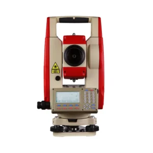
DTM-152M Total Station
Additional information
| Weight | 6.5 kg |
|---|---|
| Dimensions | 180 × 175 × 355 mm |
Specification
Telescope | ||||
| Image | Erect | |||
| Magnification | 30x | |||
| Effectiveaperture | 48mm | |||
| Resolving power | 3.75″ | |||
| Minimum focus | 1m | |||
| Stadia ratio | 100 | |||
| Sight distance precision | ≤0.4%D | |||
| Tube length | 165mm | |||
Angle Measurement | ||||
| Measuring method | photoelectric detection by incremental encoder | |||
| Diameter?of circle (vertical, horizontal) | 79mm | |||
| Minimum reading | 1″、5″、10″Selectable | |||
| Measuring unit | 360°/400gon/6400mil Selectable | |||
| Vertical angle0° | Zenith0°/Horizontal0°Selectable | |||
| Accuracy | 2″ | |||
| Distance Measurement | ||||
| Single prism(under fair weather condition) | 3km | |||
| Three prism(under fair weather condition) | 5km | |||
| Display | Max | 999999.999m | Min | 1mm |
| Unit | m/ft Selectable | |||
| Accuracy | ±(3mm+2ppm·D) | |||
| Measuring time | Fine single shot:3S | |||
| Tracking: 0.8S | ||||
| Meteorological Correction | Manual input, Auto correction | |||
| Reflection prism correction | Manual input, Auto correction | |||
Vial | ||||
| Plate vial | 20″/2mm | |||
| Circular vial | 8′/2mm | |||
Vertical Compensator | ||||
| System | Liquid-electric detection | |||
| Compensation range | ±3′ | |||
| Resolving power | 1″ | |||
Optical Plummet | ||||
| Image | Erect | |||
| Magnification | 3× | |||
| Focusing range | 0.3m~∞ | |||
| Field of view | 5° | |||
| Display | ||||
| Type | LCD,Four lines,digital | |||
| Data Communication | ||||
| Port | RS-232C,USB | |||
On-board Battery | ||||
| Power resource | Rechargeable Ni-H battery | |||
| Voltage | DC7.2V | |||
| Continuous operation time | BDC 3000mAh | |||
| Angle measurement: 20 hours | ||||
| Distance measurement: 8 hours | ||||
| Operation Environment | ||||
| Operating temperature | -20°~+45℃ | |||
| Size & weight | ||||
| Dimension | 180mm×175mm×355mm | |||
| Weight | 6.5kg | |||
You must be logged in to post a review.
Related products


Explore our full range of professional geomatics equipment designed to meet the demands of modern fieldwork across a wide variety of industries. From high-precision GNSS systems and total stations to rugged data collectors, UAV and drone solutions, and advanced LiDAR technology, every product we offer is carefully selected for performance, durability, and ease of use in real-world conditions.
Whether you are conducting land surveying, construction layout, mapping, or managing complex geospatial data, Geomatics Gear provides reliable tools that help you maintain accuracy and efficiency on every project. Our solutions are built to perform in challenging environments, ensuring consistent results when it matters most.
In addition to top-tier equipment, our team offers knowledgeable support to help you choose the right tools for your workflow. With Geomatics Gear, you gain access to trusted technology and expertise that keeps your projects moving forward with confidence.
Reviews
There are no reviews yet.