SKYCRUISER A22
● Quick hand launch & belly landing
● 20.1 MP imaging sensor with 21mm Voigtlander lens
● RTK waypoint navigation, and precise landing control within 5m radius
● Mapping accuracy down to centimeter level by PPK corrections
Model: Standard Version A22 / Professional Version A22-Plus
Features
SkyCruiser A20 series understands 100% what surveyors really need…
What shall be considered before purchasing a mapping drone?
Easy operation
Automated control
Output quality
Survey-grade demand
Cost efficiency
Responsive support
A professional-level drone made for survey-grade mapping applications...
Simple assembly and quick hand launch
Humanized GCS software with interactive interfaces
Excellent flight attitude due to moderate drone weight
Quality imageries to generate survey-grade outputs
Reasonable costs versus high work efficiency
Trusted local dealer and renowned survey manufacturer standby

Additional information
| Weight | N/A |
|---|---|
| Dimensions | N/A |
| Model | A22 Plus, Standard Version A22 |
Specification
Aircraft System aircraft type fixed wing
wingspan 150 cm
take-off weight A22: 1.45 kg; A22-Plus: 1.55 kg
power supply lithium polymer battery
battery power 10000mAh, 14.8V
body material industrial EPO foam
Flight Performance take-off method hand launch/ automatic
landing method typical, precise parachute landing; optional, belly landing
maximum ceiling 4000 m
working height 70-940 m AGL (Above Ground Level)
cruising speed* typical 20 m/s (72 km/h)
endurance not less than 59 minutes, best up to 80-85 minutes (customized unit only)
single flight range* approx. 80-90 km
single flight coverage* —
landing space typical 20 x 6 m; recommended 50 x 10 m
Operation Performance base observations integrated with radio datalink device
radio datalink Frequency Hopping Spread Spectrum (FHSS)
control frequency 915 MHZ
radio communication range typical, 5-10 km; maximum 30 km
weather limit 10 m/s (36 km/h), Beaudfort scale 6, light rain
operating temperature -10℃ to 45℃
Ground Control auto return —
drone tracking APP display via pre-installed GPS tracker
Note1: all aspects marked with * are determined by weather conditions and manual operations in practice.
Note2: all information above is subject to change without any prior notice.
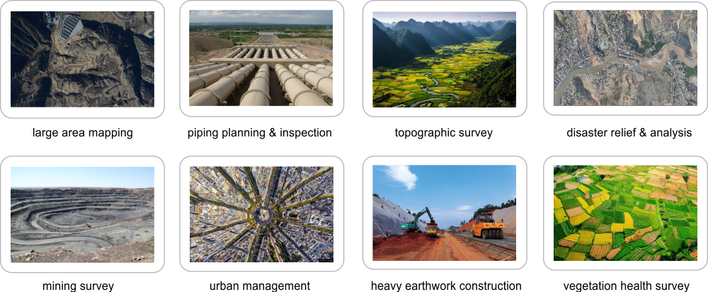
Applications

Brochure Download
You must be logged in to post a review.


Reviews
There are no reviews yet.